
Historic Columbia River Highway - Rowena Crest Overlook
Hood River · park
Visit
Plan a visit
Save this place, get directions, or start a short trip plan. Hours and amenities are listed below.
Search to see a fit score for your needs.
Essentials
At a glance
- Hours
Open 24 hours daily
- Amenities
On site
Visitor amenities
…be in nature
- Vista Pointnature
- Hiking Trailsnature
Location map
Pin location for directions and nearby context.
On the ground
Trails
Overview
About this park
This viewpoint also serves as a trailhead for adjacent Tom McCall Nature Preserve .
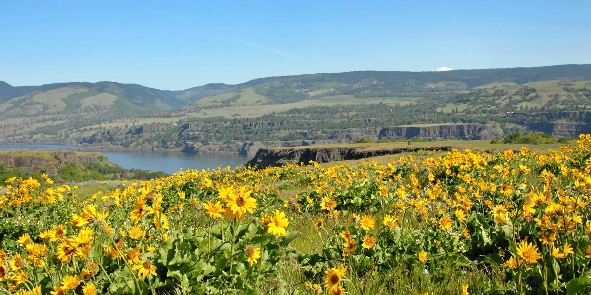
Each spring, the Rowena Plateau bursts into bloom with native lupine, balsamroot and other wildflowers. Hikers can take the 2.
To get there, take exit 69 off I-84 from Mosier and head east about 7 miles on Highway 30, or take the Rowena exit (#76) and head west on Highway 30 up the famous “Rowena Curves.
Setting
Landscape & setting
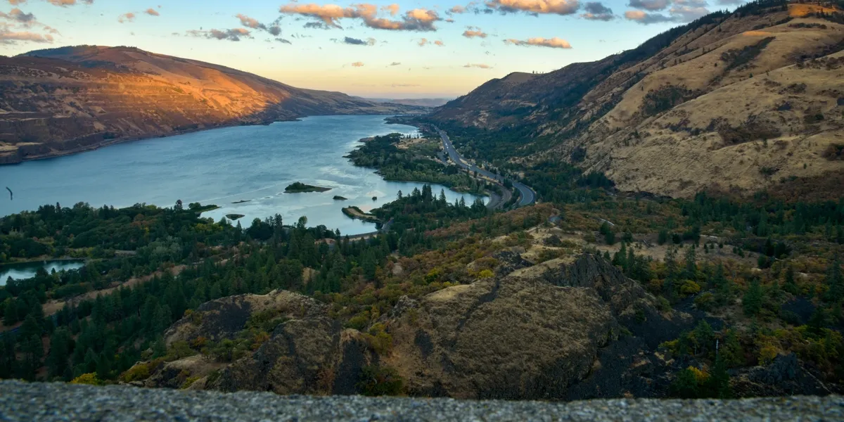
The view includes the iconic Rowena Loops — the horseshoe curves that wind up to the viewpoint, a true engineering marvel.
Things to do
Things to do
6-mile Plateau Trail for views of the epic geologic formations carved by Ice Age floods. Or, try a more challenging 4-mile out-and-back hike to McCall Point.
Pet policy
Dogs & pets
” Know Before You Go There are no restrooms at Rowena Crest. Visit Lower Mayer for public facilities. No dogs allowed in the Tom McCall Nature Preserve.
Background
History & notes
Rowena Crest is a stunning viewpoint and trailhead along the Historic Columbia River Highway that looks down on Mayer State Park and the Columbia River Gorge.
Today
Weather
Forecast is advisory — confirm park hours before you go.
Plan your visit
Nearby
More parks in Hood River
Data quality
Sources
Confidence checks: coordinates · website · image · hours · amenities (and last verified when known).
Confidence score
74/ 100
Oregon State Parks Website
- official website
- coordinates
- amenities
- hours
- image
- last verified
Confirm hours on the official page before visiting.