
Starvation Creek State Park
4.7Google rating(600 reviews)Hood River · park · 147 acres





Visit
Best for
Essentials
At a glance
- Hours
See official page for current hours
On site
Visitor amenities
…stay a while
- Restroomfacility
- Picnic Areafacility
- Parkingfacility
- Drinking Fountainfacility
- Accessible Featuresfacility
…be in nature
- Vista Pointnature
- Wildlife Viewingnature
- Hiking Trailsnature
…culture & learning
- Interpretiveculture
Access
Accessibility
- Wheelchair accessible
- Accessible parking
- Accessible restroom
- Accessible trail
- Accessible entrance
Inferred from amenities/description; confirm on official sources.
Browse wheelchair-accessible parksPark size map
Official park boundary from GIS.
On the ground
Trails
Overview
About this park
Zooming eastbound down Interstate 84, you might very well miss this tiny park.
The final section crosses a talus slope at Shellrock Mountain, where fences offer protection from falling rocks.
The following devices are not allowed: electric scooters, mountain boards, electric unicycles, and other similar devices.
For more information, please call Viento State Park at 541-374-8811.
Access
Access & hours
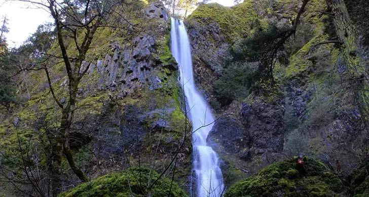
Nestled at the base of the sheer walls of the Columbia Gorge, the park’s namesake Starvation Creek Waterfall is just over a boardwalk, 50 feet from the parking area.
On site
Amenities & facilities
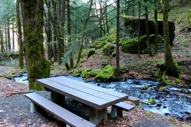
Picnic tables feature views of the falls. This park is also a trailhead for the paved Historic Columbia River Highway State Trail that traces the original historic highway.
Things to do
Things to do
This section of trail travels through thick fir forests and lush undergrowth—moss often carpets portions of the paved trail.
Near Hole-in-the Wall Falls, hikers will find the trailhead for Mount Defiance Trail (#413) .
For trail information, see our Historic Columbia River Highway State Trail bicycle and hiking map.
Setting
Landscape & setting
When the forest breaks, look for views across the Columbia River into Washington. Hikers and bikers can also head west 4.
6 miles to Wyeth Campground and trailhead, passing Cabin Creek Falls, Hole-in-the-Wall Falls and Lancaster Falls before climbing to an impressive view of the Gorge.
Pet policy
Dogs & pets
Know Before You Go Dogs are allowed on trails, but must be on a leash no longer than 6 feet at all times. E-bikes are allowed on the Historic Columbia River Highway State Trail.
Background
History & notes
Land was purchased from private owners between 1930 and 1960. There are two theories on the origin of the name Starvation Creek. It is said that a party of overland pioneers nearly starved here for lack of provisions. The place also was called Starveout after two Union Pacific Railroad trains were stalled in the area by heavy snows in the winter of 1884-1885. For some days, the passengers were kept from starvation by men who packed supplies from Hood River on skis.
Today
Weather
Forecast is advisory — confirm park hours before you go.
Plan your visit
Nearby
More parks in Hood River
Data quality
Sources
Confidence checks: coordinates · website · image · hours · amenities (and last verified when known).
Confidence score
85/ 100
Oregon State Parks
- official website
- coordinates
- amenities
- hours
- image
- last verified
Unknown statuses are not treated as open.