
Rock Creek Trail
Portland · Washington County · Tualatin Hills (Beaverton area)
Visit
Plan a visit
Save this place, get directions, or start a short trip plan. Hours and amenities are listed below.
Search to see a fit score for your needs.
Essentials
At a glance
- Hours
See official page for current hours
- Amenities
On site
Visitor amenities
…stay a while
- Accessible Featuresfacility
…be in nature
- Trailnature
Trail map
Trailhead pin — full line geometry is not in open data for this route yet.
Overview
About this park
Within THPRD boundaries, the Rock Creek Regional Trail consists of 3. 5 miles of ADA-accessible trail in the northernmost part of the park district. (An additional 1.
toward the Washington/Multnomah County line.
Things to do
Things to do
5 mile trail segment extends south from Rock Creek Park into the City of Hillsboro.
) The trail is named for Rock Creek, a tributary of the Tualatin River with headwaters in the Tualatin Mountains (West Hills) to the north.
Rock Creek intersects the trail just west of Bethany Lake Park . The trail runs west to east along Springville Creek and a powerline corridor from Rock Creek Blvd.
As with most of THPRD's regional trail systems, the Rock Creek Regional Trail is mostly flat, allowing young bike riders a welcoming place to learn or practice their riding.
The trail also connects people to the Portland Community College's Rock Creek campus and intersects the north-south Waterhouse Trail .
The Oregon Department of Fish and Wildlife stocks the lake with trout, and fishing is welcome with a valid Oregon fishing license.
Further east along the trail is Bethany Meadows Park, one of THPRD's most popular parks.
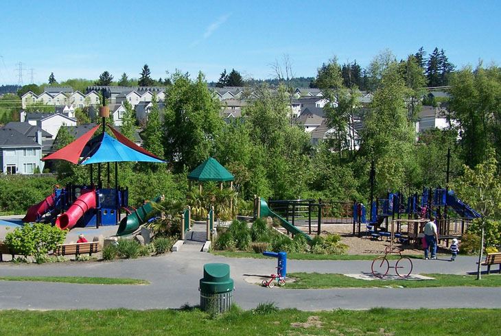
Commonly known as " Pirate Park," it's a great play destination for its ship-themed play structure, climbing features, lookout tower, and sandpit.
On the far east end of the Rock Creek Regional Trail is Kaiser Woods Natural Area, which boasts wildflowers in the spring and woodland songbirds year-round.
To follow the Rock Creek Trail into Hillsboro: Visitors must travel along streets for about three-fourths of a mile to connect the trails.
and Rock Creek Park. The Rock Creek Trail resumes just east of Rock Creek Park. Forms & Documents: Log in to Your Volunteer Account Here!
Setting
Landscape & setting
It passes through forests, wetlands, meadows, and a variety of parks, making it a great destination for walking, running, biking, recreation, and wildlife viewing.
Other songbirds can be appreciated along Springville Creek, and osprey and a variety of waterfowl can be spotted at Bethany Lake Park.
From the west end of Bethany Lake Park, turn left on to NW Neakahnie Ave. From Neakahnie, turn left onto NW Mahleur Ave. and follow it to NW Rock Creek Blvd.
Access
Access & hours
On the far west end of the trail is the Rock Creek Powerline Soccer Fields, followed by Bethany Lake Park, which has ample parking off of NW 185th Avenue.
In open areas along the trail, Red-tailed Hawks and kestrels fly overhead.
Pet policy
Dogs & pets
Parks & Trails: Parks Trails Community Gardens Dog Parks Memorial Bench Program Natural Areas Park Rentals
Today
Weather
Forecast is advisory — confirm park hours before you go.
Nearby
More parks in Portland
Data quality
Sources
Confidence checks: coordinates · website · image · hours · amenities (and last verified when known).
Confidence score
89/ 100
THPRD Parks Website
- official website
- coordinates
- amenities
- hours
- image
- last verified
Unknown statuses are not treated as open.