
Elijah Bristow State Park
4.6Google rating(442 reviews)Eugene · park · 848 acres



Visit
Best for
Essentials
At a glance
- Hours
7:00 AM – 7:00 PM daily
On site
Visitor amenities
…stay a while
- Restroomfacility
- Picnic Areafacility
- Parkingfacility
- Accessible Featuresfacility
…be in nature
- Vista Pointnature
- Wildlife Viewingnature
- Horse Trailsnature
- Bike Pathnature
- Hiking Trailsnature
…near water
- Fishingwater
- Watercraftwater
Access
Accessibility
- Wheelchair accessible
- Accessible parking
- Accessible restroom
- Accessible trail
- Accessible entrance
Inferred from amenities/description; confirm on official sources.
Browse wheelchair-accessible parksPark size map
Official park boundary from GIS.
On the ground
Trails
Overview
About this park
Elijah Bristow State Park is located on the Middle Fork of the Willamette River, and is easy to reach by State Highway 58, located southeast of Eugene.
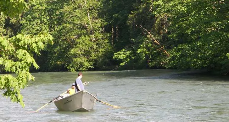
Salmon and steelhead trout abound during annual runs in one of the few stretches of the lower Willamette with fast-moving white water.
Elijah Bristow is also home to several threatened species, including the Western pond turtle and the Oregon chub.
A dense canopy of broadleaf and evergreen trees with a lush understory of shrubs and herbaceous plants provides an excellent area for nature study and outdoor education.
On site
Amenities & facilities
Three reservable group picnic areas, and numerous first-come, first-served picnic sites provide plenty of opportunity to relax and enjoy nature.
A separate equestrian staging area with a picnic shelter, barbecue grills, tables, water and a restroom make Elijah Bristow a favorite destination with local riding clubs.
Setting
Landscape & setting
Unique wildlife nesting and habitat areas fill the park's islands and sloughs.
Channel Lake, a land-locked river channel that meanders through the park, eventually empties back into the Willamette River and provides habitat for osprey, great blue heron, bald eagles and beaver.
Things to do
Things to do
Elijah Bristow has more than 10 miles of trail for hikers, mountain bikers and equestrians (electric-assisted bicycles are not allowed).
Part of the trail system includes a portion of the Eugene to Pacific Crest trail.
Background
History & notes
Acquired between 1971 and 1979 by gift from Lane County, transfer from the State Lands Division and purchase from various private owners, the park lies along the Middle Fork of the Willamette River just below Dexter Dam. Authorized for Willamette River Greenway acquisition by the 1973 State Legislature. Originally called Dexter State Park, the park name was changed in 1979 to honor Elijah Bristow (1788-1872), known as one of the first Euro-American settlers in Lane County. On his claim, Bristow founded the community of Pleasant Hill, located some 10 miles west of the park on Highway 58.
Today
Weather
Forecast is advisory — confirm park hours before you go.
Plan your visit
Nearby
More parks in Eugene
Data quality
Sources
Confidence checks: coordinates · website · image · hours · amenities (and last verified when known).
Confidence score
85/ 100
Oregon State Parks
- official website
- coordinates
- amenities
- hours
- image
- last verified
Confirm hours on the official page before visiting.